houston megastructure
cuarch 401 competition studio, fall 2014
prof. David Dewane
winner, competition studio

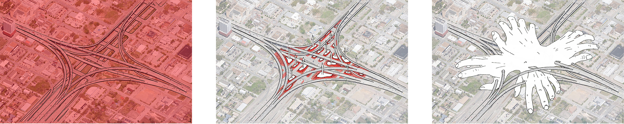
The first response to the question of designing housing near a massive highway interchange outside downtown houston framed the problem locally: the highway is inhuman and toxic, and violently divides four neighborhoods. Thus, the response is to pull the urban fabric (warm, human) through the highway, connecting the divided neighborhoods, and have it grow a protective shell so it could survive within the hostile environment.
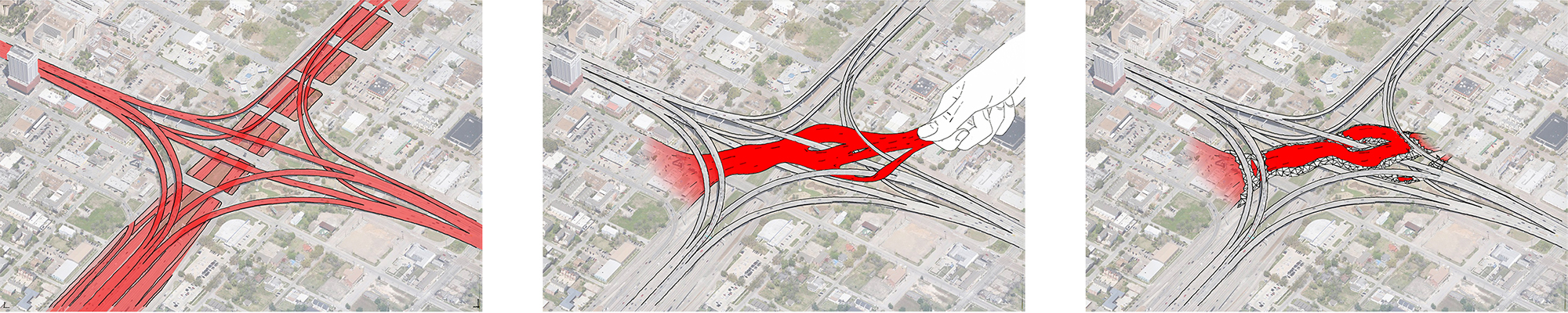
However, the question of the highway involves the lifestyle and urbanism that it symbolizes. The organizational pattern of Houston - and any modern city - is violently hierarchical.
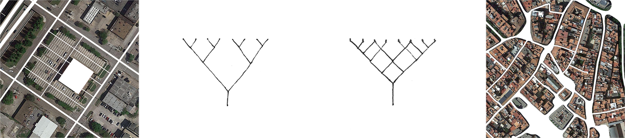
It is a tree structure, where each endpoint (person, building) must descend to the trunk (car, highway) to communicate with another, resulting in a very alienated way of living. The alternative to this organization is the rhizome, where the endpoints communicate in a horizontal manner.
An example of this could be the old city of Barcelona - or any premodern city - which is a horizontal web of nodes (courtyards) and connections (streets).
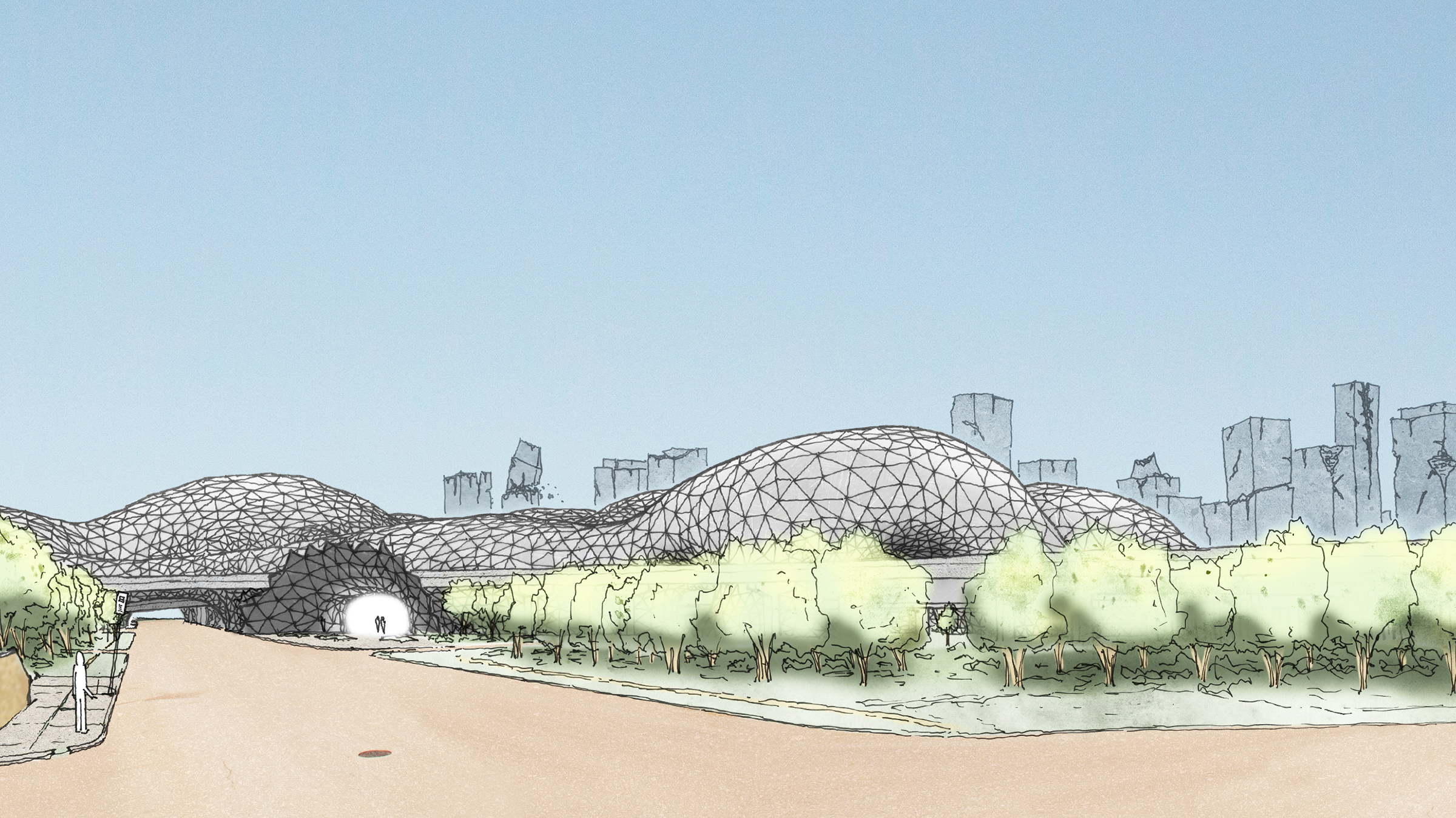
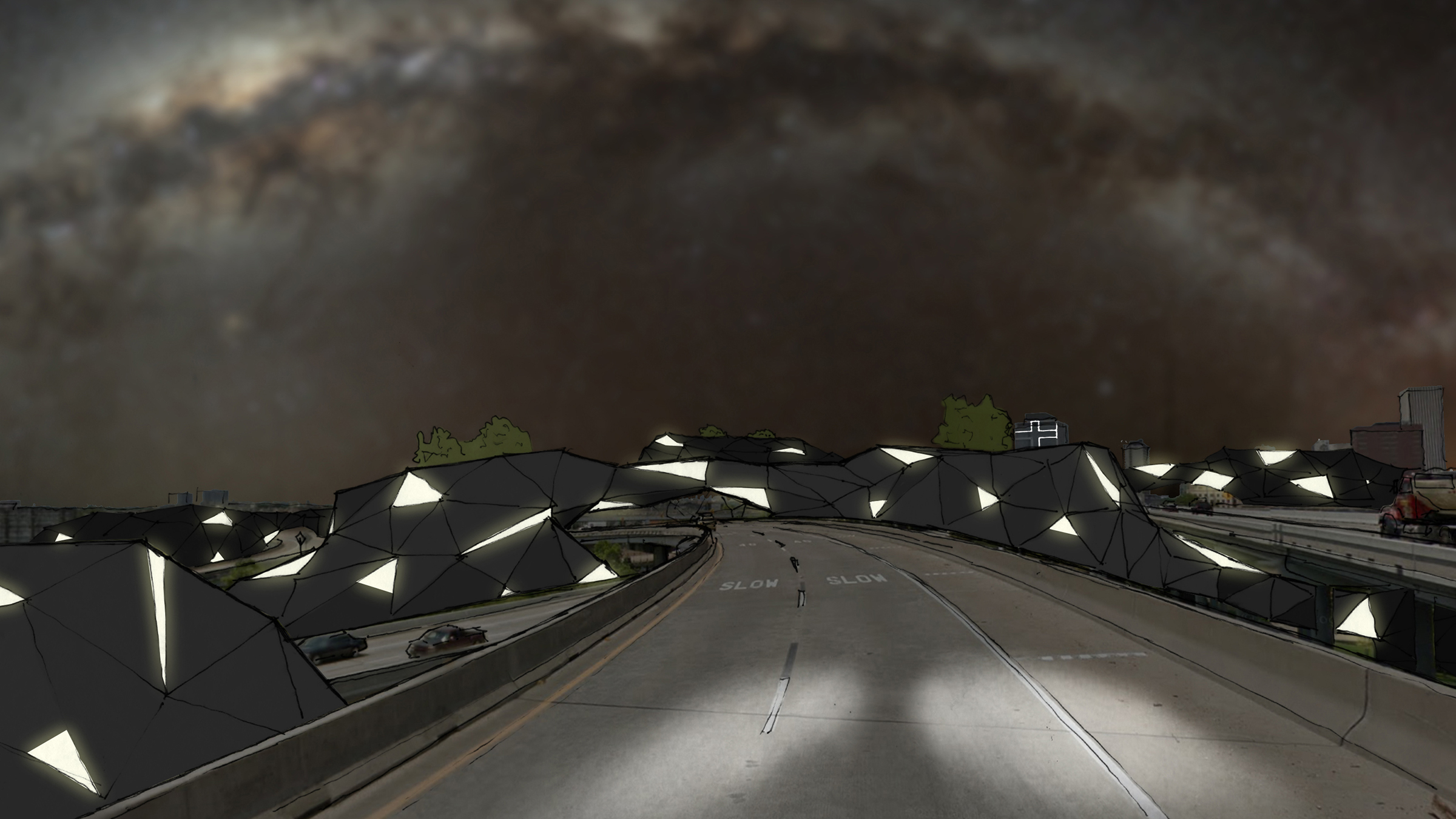
With the entire surrounding area designed with these alienating principles, the only way to create a rhizomatic housing system - where human lives spill onto each other - is to have it grow spontaneously out of the ground. As it grows, always protected by its shell, it eats the highway - connecting the four neighborhoods - and threatens to conquer the rest of the city.
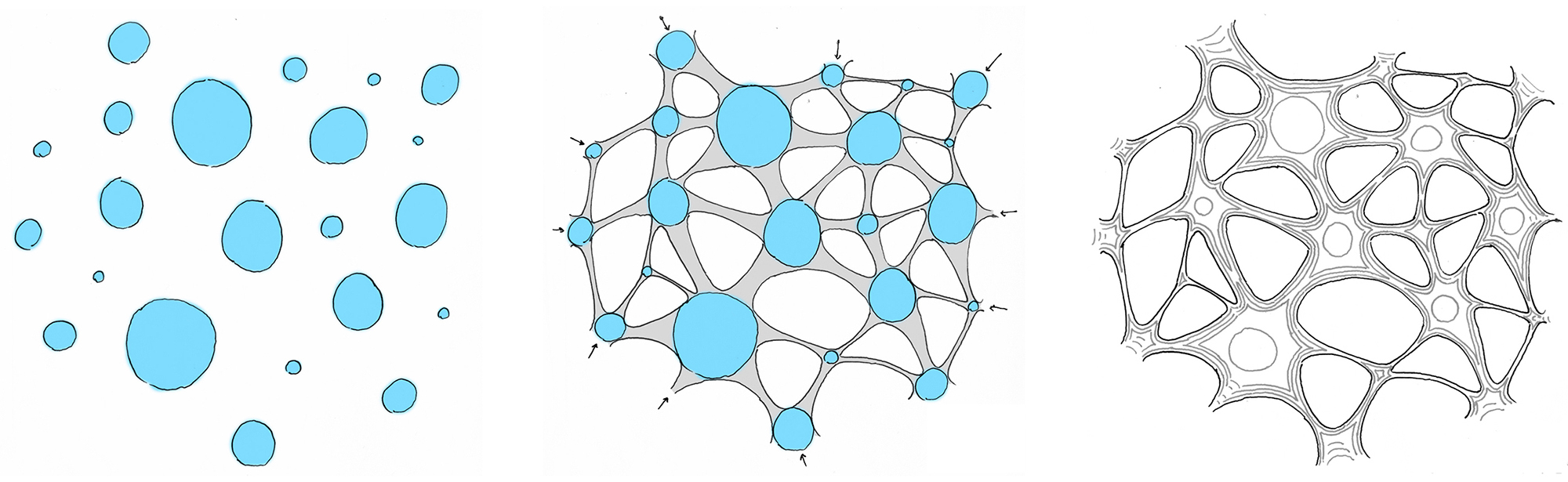
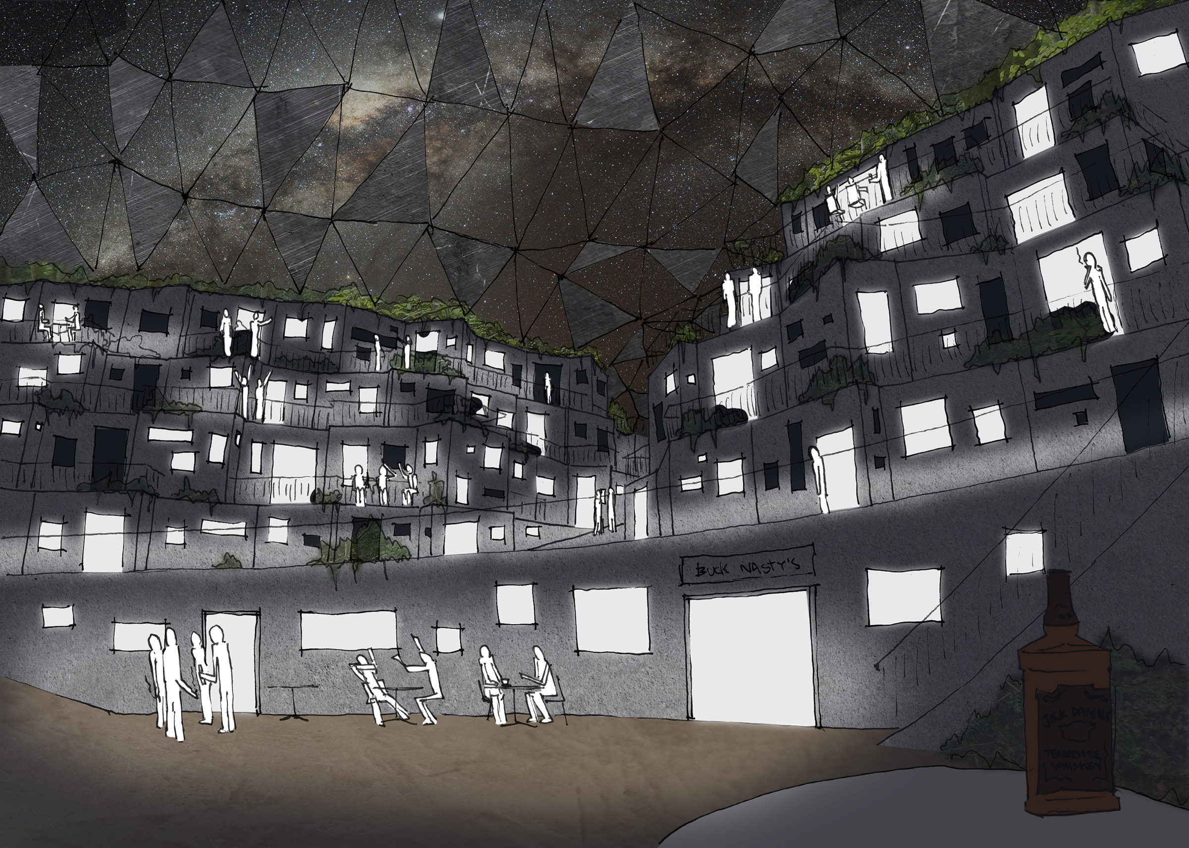
The system begins with a series of nodes - public spaces - placed in the voids between the over-passes. These are joined by the protective shell, forming the system of nodes and connections. The housing units then accrete like barnacles on the inside of the shell.
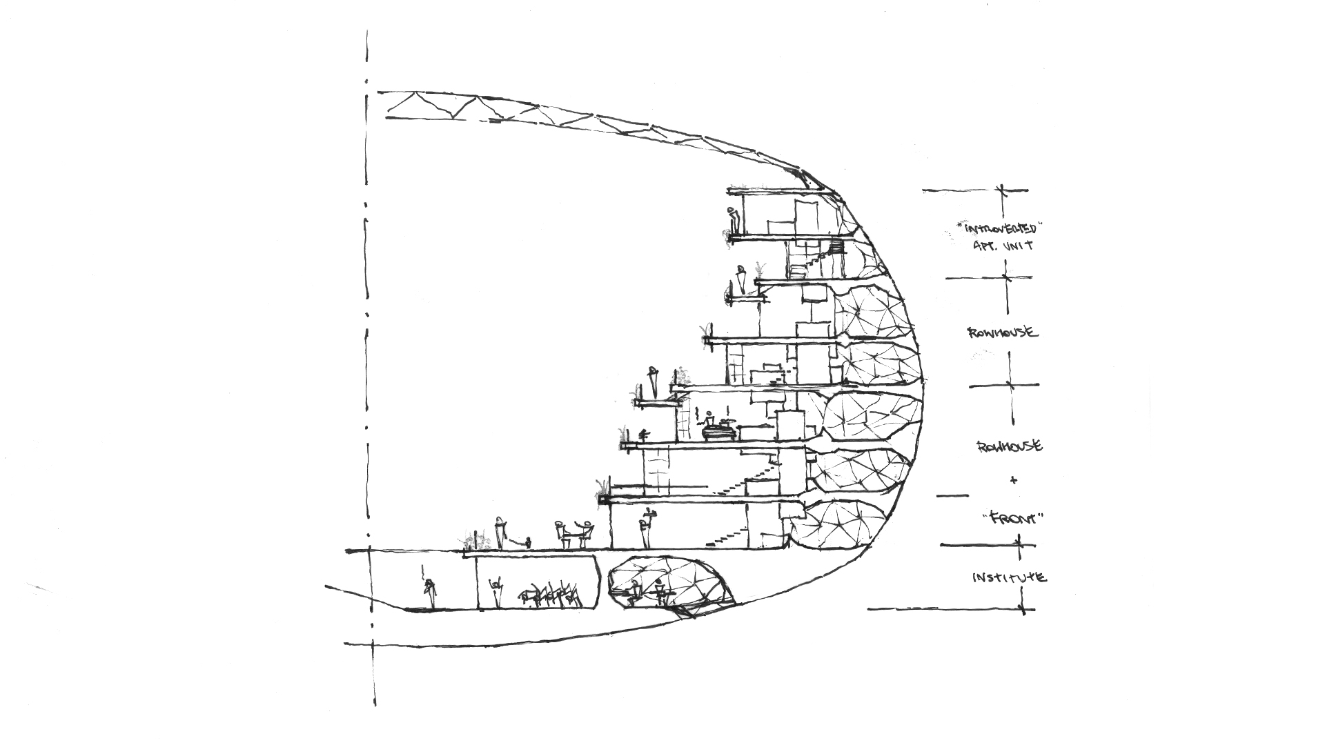
These units are conceived as two-story row-houses where each unit is connected to both the public life of the inner space and the dystopic science-fiction landscape of outer shell and highways.
This composite samples Richie Gelles' Houston.
The units are stacked on top of each other two or three times, depending on the size of the node. All circulation takes place within the central space, with secondary ‘streets’ providing access to the higher units. The lowest unit has a (perhaps commercial) front beneath it, to be used by those who live above it.
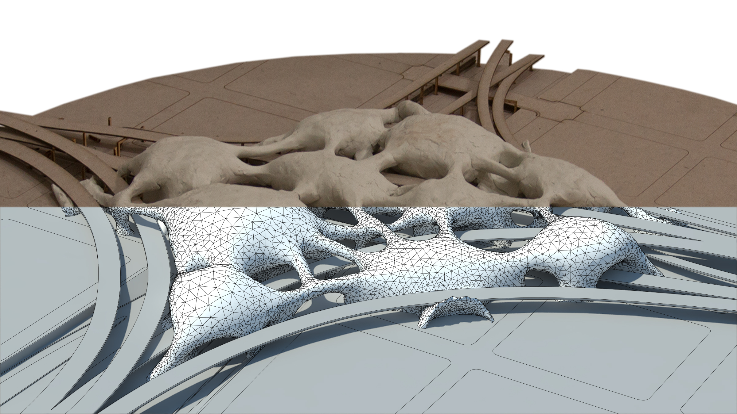
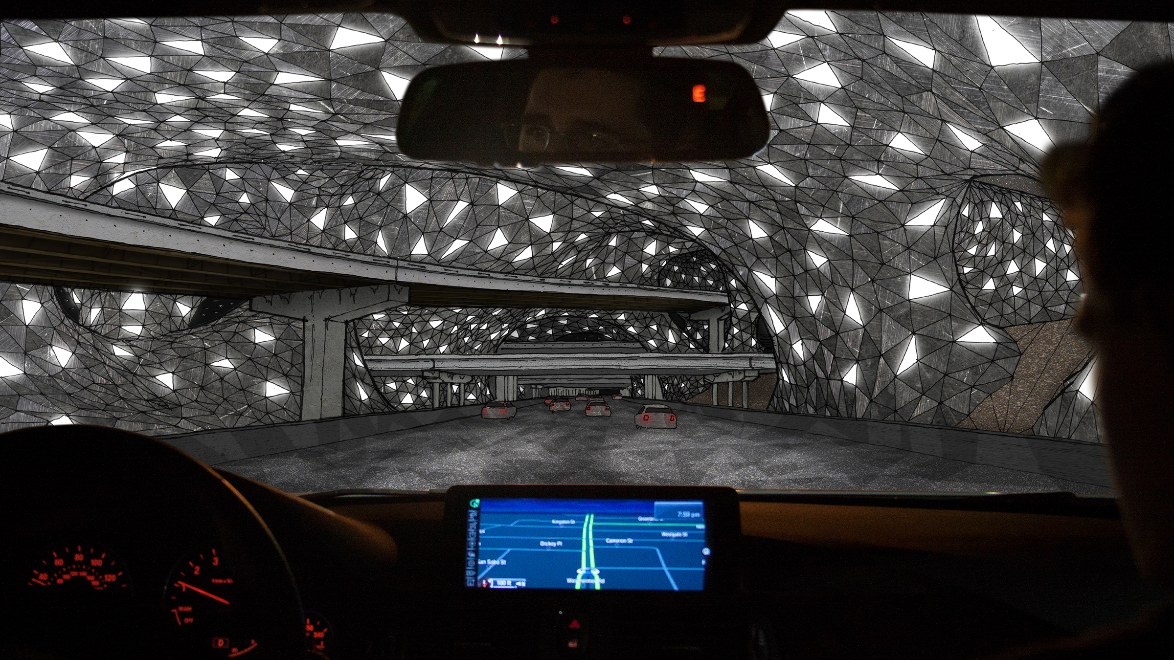
When applying this system to the site, I found that the best way to generate the forms was to sculpt plastilene with my hands on a physical model. I then used a 3-d scanner to bring the geometry into the computer, where I fine-tuned the way it met the ground, and simply reduced its resolution to arrive at the final form: a triangulated mesh, the way in which the computer (logical, hierarchical) understands the organic (rhizomatic).
Passing Underneath
(In photo: colleagues Graham Rice and John Homer)
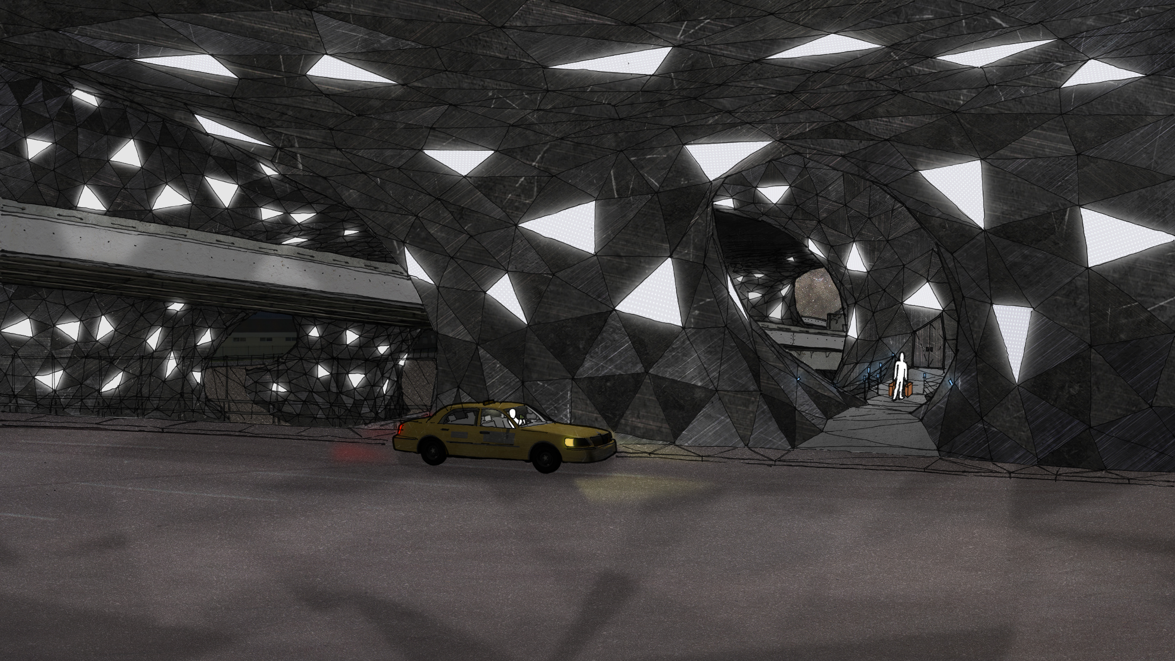
At Street Level
(auxiliary entrance)
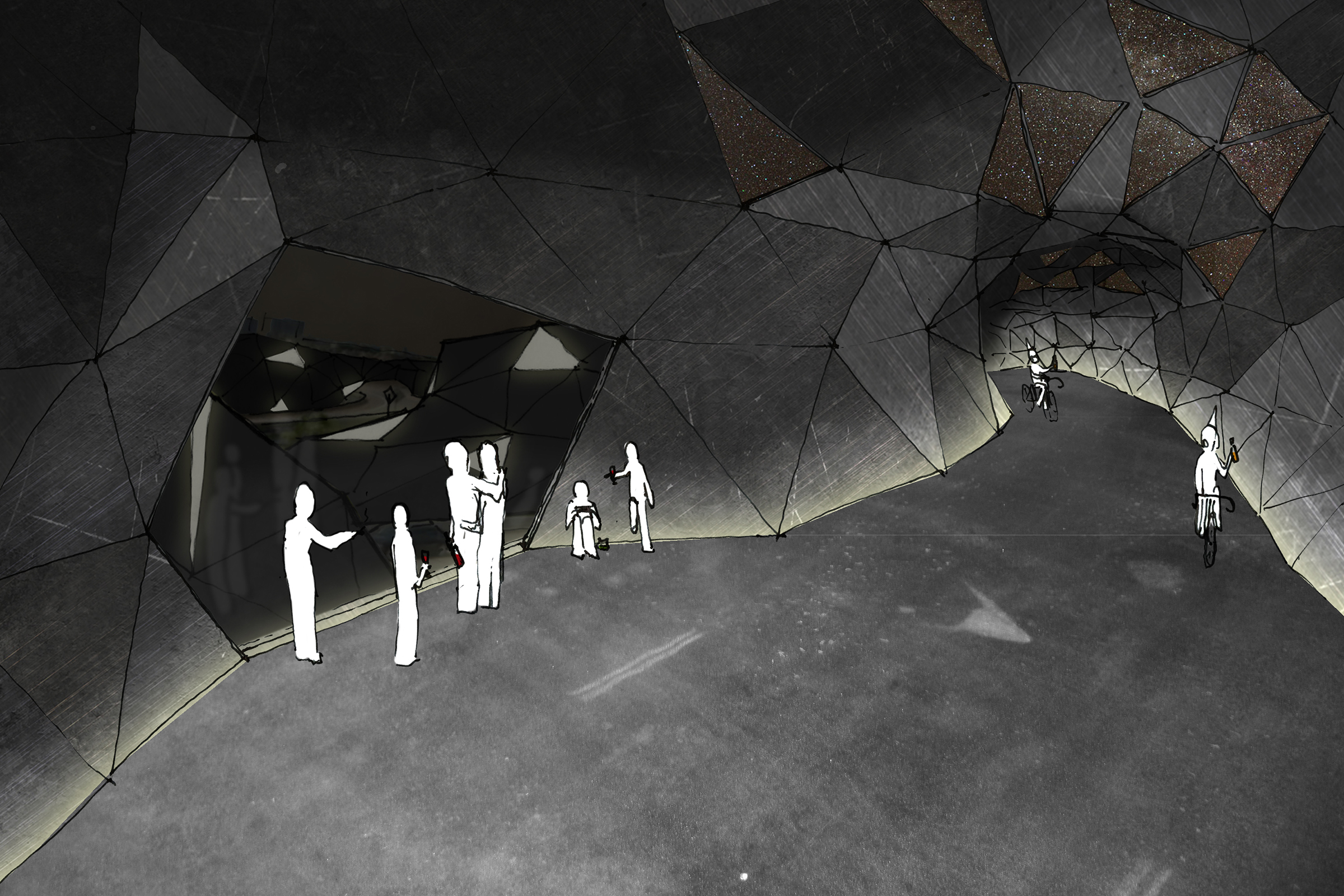
Inside Connecting Paths
(street as place to be)
Arriving at Node
(entering medieval village)
Node Interior
(coffee shop)
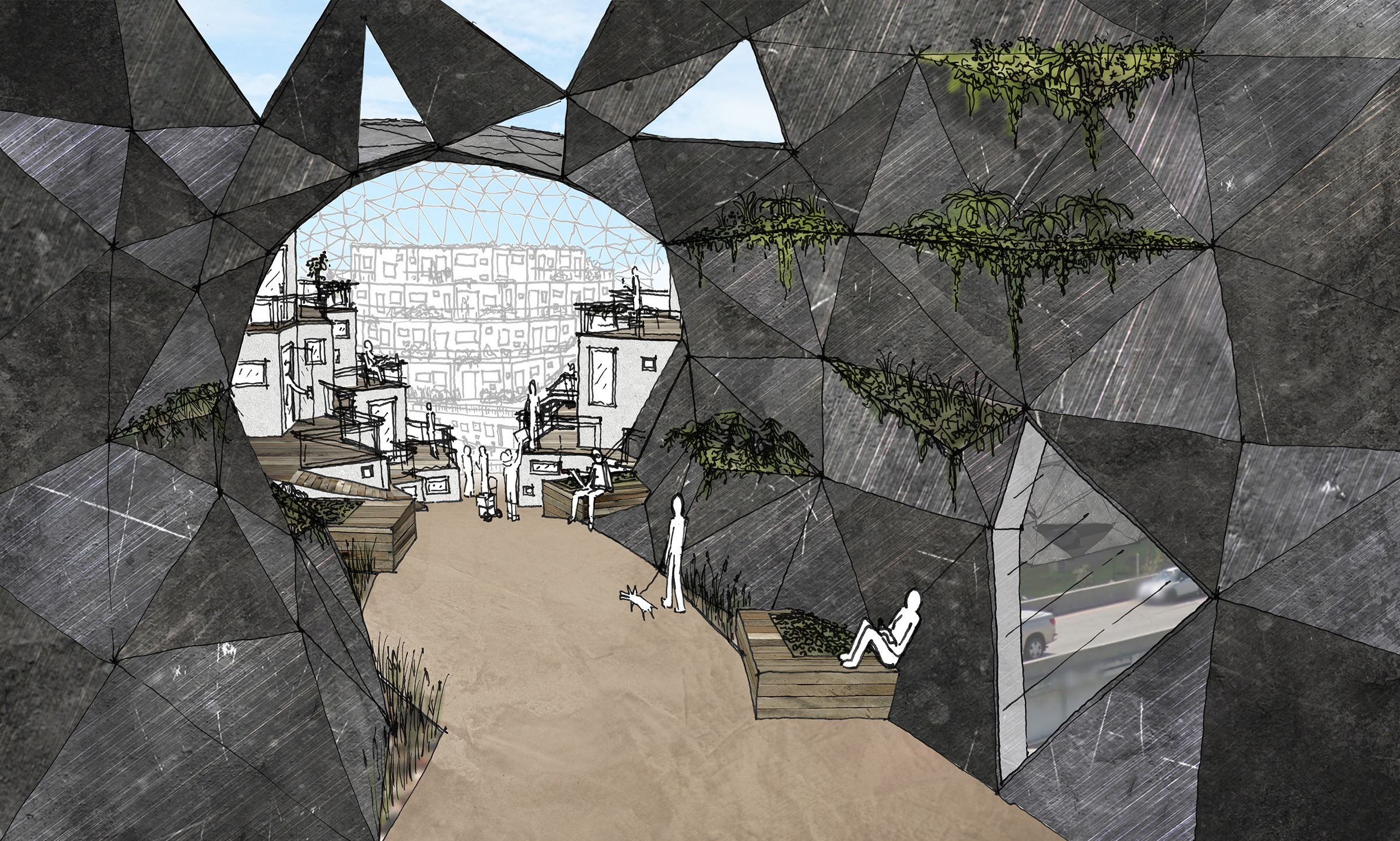
View from Third Ward
(challenging the way of life)